Beijing’s mega-dam on Tsangpo River threatens Tibet as much as India and Bangladesh – Firstpost
&w=1200&resize=1200,675&ssl=1 "Beijing’s mega-dam on Tsangpo River threatens Tibet as much as India and Bangladesh – Firstpost")
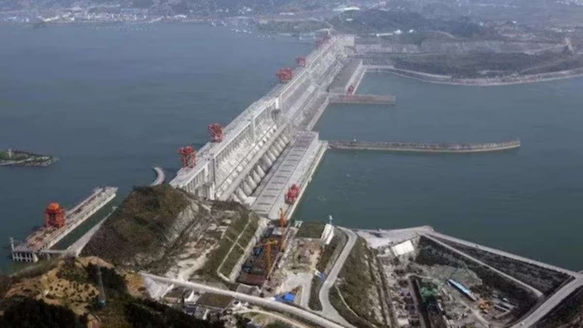
Very few news items have generated as much ink as the announcement of Beijing’s approval of the construction of a mega hydropower project (HPP), which could produce three times more energy than the Three Gorges Dam, on the Yarlung Tsangpo River in Tibet.
After it was reported by the Xinhua news agency on December 26, innumerable comments started pouring in from the Indian media.
Interestingly, the Chinese report did not specify when construction would start and what type of hydropower plant (or plants) would be built.
The project has been in the pipeline for decades; already in November 2020, Beijing had included the survey of the Great Bend of the Yarlung Tsangpo (which becomes the Siang in Arunachal Pradesh and then the Brahmaputra) in China’s 14th Five-Year Plan (2021-25) for this purpose.
When The Global Times announced that Beijing was going to build a cascade of nine large HPPs on the Yarlung Tsangpo, human rights groups raised concerns, fearing displacement of locals and adverse environmental impact on the downstream countries of India and Bangladesh.
The point remains that despite the innumerable articles and experts’ comments, one knows practically nothing about the technical and geographical aspects of the project.
In 2020, Yan Zhiyong, then chairman of state-owned Power Construction Corporation of China, had indicated that the Great Bend of the Yarlung Tsangpo was the most hydropower-rich region in the world: “The lower reaches area features a vertical drop of 2,000 meters over a 50 km distance, representing nearly 70 million kilowatts of resources that could be developed—that is more than three Three Gorges Dams with an installed capacity of 22.5 million kilowatts,” he asserted.
Four years ago, it was clear that the idea of a single dam had been abandoned for a series of 9 or 10 large run-of-the-river HPPs with minimum reservoirs.
Why has the mega-dam concept returned now? Nobody knows the answer. One possibility is that the story could have been planted by China to spread fear downstream, in India in particular.
The Tingri Earthquake
Coincidentally, less than two weeks later, on January 7, an earthquake measuring 7.1 on the Richter scale struck Tingri County, near Shigatse in Central Tibet.
According to Chinese sources, at least 126 people were killed and 338 were injured in the region, although Tibetan officials believe that the true death toll would be higher as outsiders were prohibited from entering the area.
The earthquake was the fiercest on the Tibetan plateau (and in China) since the 2021 Maduo earthquake in Qinghai Province, also known as the 5.22 (May 22); the Jishishan earthquake (in Gansu) in December 2023 caused 151 deaths and 982 injuries, while the 2014 Ludian earthquake (in Yunnan) killed 615 people and injured 2,400 others, with over 12,000 houses destroyed.
According to the China Earthquake Networks Centre (CENC), “Since 1950, 21 earthquakes above magnitude 6 have happened in the Lhasa region, with a maximum magnitude of 6.9.”
The Seismicity of the Himalayan Belt
Closer to India, the seismicity of the Great Bend of the Yarlung Tsangpo and the Himalaya in general has been one of the main objections to any mega (or even large) projects in the area. This is indeed a serious issue.
China Daily recently reported, “It happened following a northward compression from the Indian Ocean plate and crustal movement. The northward compression from the Indian Ocean plate is the result of the Indian plate’s collision with the Eurasian plate.”
Let us not forget that this collision is responsible for the formation of the Himalaya.
Despite the vagueness of the Chinese announcement, the ambiguity of the Indian protest, and the Chinese Foreign Ministry spokesperson Mao Ning’s denial that the megastructure could have an effect on India: “China has always adhered to a responsible attitude toward the development of cross-border rivers,” she said; the earthquake in Tingri brought the vital issue to light.
On August 15, 1950, the Assam-Tibet Earthquake of magnitude 8.7 took place in what is today’s Lohit and Anjaw districts of Arunachal Pradesh. The Dalai Lama, who was 15 at the time, noted in his memoirs: “It was like an artillery barrage—which is what we assumed to be the cause of both the tremors and the noise: a test of some sort being carried out by the Tibetan army… Some people reported seeing a strange red glow in the skies in the direction from which the noise came….”
The 1950 quake happened not very far from the Great Bend (and Upper Siang), which changed the course of the river. The seismicity is the same across the entire region. If you consider the fact that the latest earthquake has occurred in Tingri, which is on the plateau above Nepal, building a dam in Upper Siang, Lohit, or Subansiri is far more dangerous.
The problem is that the ‘dam lobbies’, which are still very active in China, and the People’s Liberation Army (PLA) themselves lobby hard to construct dams, which means a lot of money.
Different avatars of the HPP project have been rejected by the Chinese scientists over the years; it remains that the location of the HPPs, not far from the Indian border, is particularly worrying for its large hydropower potential and the seismicity of the area.
Will scientific thinking and common sense, or the power and money lobby, prevail? That is the real question.
The Groundwork
Though it is true that the development of hydropower “has undergone several decades of in-depth research,” as the spokesperson Mao put it, one can seriously doubt that the new development, if it happens, will have no implications for the areas downstream, though the area where the HPPs are planned is located between the town of Pai in Nyingchi City and Drepung (Beibeng) near the Indian border (Upper Siang district of Arunachal Pradesh), which is a very sparsely inhabited area. When the Indian media speaks of the ‘relocation’ of population, it is wrong.
After the National People’s Congress (NPC) said in 2021 that “the building of hydropower bases on the lower reaches of the river is among the priority energy projects”, some groundwork needed to be made.
First, the Pai-Metok (Pai-Mo) Highway linking Nyingchi to Metok, north of Upper Siang district of Arunachal Pradesh, which was opened in July 2021. After the completion of the highway, the length of the road from Nyingchi City to Metok County was shortened from 346 kilometres to 180 kilometres, and the driving time was shortened from 11 hours to 4.5 hours. Technically, in strategic terms, a 67-kilometre-long highway (and a tunnel under the Doshung-la mountain) will be a game changer; it could pave the way to the 9 or 10 HPPs.
Evacuation in the Shigatse Area
More interesting, ten days after the earthquake, Reuters reported: “Chinese authorities in Tibet have detected problems, including cracks, at five out of 14 hydropower dams that they have inspected since a magnitude 6.8 [or 7.1?] earthquake rocked the southwest region last week.”
The agency quoted a Chinese official in Tibet: “Of the five affected dams, three have since been emptied, the Tibet emergency management official told a press conference. In the county of Tingri, the quake’s epicentre, the walls of one hydrodam have tilted, prompting the evacuation of about 1,500 people from six villages downstream to higher ground,” he said.
The general lack of details is confusing, as there is no large hydropower plant in Western and Central Tibet, except the small Ngari dam located just outside Gar (Chinese, Shiquanhe) on the Indus River and a newly commissioned dam near Purang (north of the trijunction Nepal-Tibet-India). There are no other large dams.
Irrigation Projects
It appears that the Reuters news item may be referring to the Lahlo (Chinese, Laluo) Water Conservancy Hub and Associated Irrigation District Project, located in Lahlo Township, Sagya County of Shigatse City, on the right bank of the Yarlung Tsangpo. It is not a hydropower plant but an irrigation project.
The other possibility is the Kangcho (Chinese, Kangzhuo) Reservoir Project, located in Kangcho Township, Gyantse County, 20 kilometres away from Shigatse City. It is one of the important projects in the water conservancy included in the 14th Five-Year Plan for water security. The main objective of the Kangcho Reservoir is to provide irrigation to an area of 46,500 acres.
The vague announcement by Beijing of the impending construction of a dam on the Yarlung Tsangpo does not tally with President Xi Jinping’s New Year message, which insisted on the importance of international cooperation; a unilateral decision to go ahead with the HPP project would be the opposite.
In any case, the day it happens, it will have incalculable strategic and environmental implications for India; the HPPs, being located just north of the McMahon Line, would indeed threaten India’s entire North-East region… and Bangladesh.
India needs to seriously engage China, diplomatically and otherwise, with factual data and scientific arguments; it will of course be more difficult to take Bangladesh on board in the present political circumstances.
The writer is Distinguished Fellow, Centre of Excellence for Himalayan Studies, Shiv Nadar Institution of Eminence (Delhi). Views expressed in the above piece are personal and solely those of the writer. They do not necessarily reflect Firstpost’s views.
&w=1200&resize=1200,675&ssl=1 "How civil wars in Sudan and South Sudan jeopardise Africa’s security – Firstpost")
&w=1200&resize=1200,675&ssl=1 "Europe woos Trump but fumbles on Russia – Firstpost")
&w=1200&resize=1200,675&ssl=1 "Why do nations acquire nukes? Decoding Iran’s dilemma – Firstpost")


Post Comment